
Input Files
The traffic modelling uses the 4 following files / QGis layers :
- a “links” file, or multiline QGis layer
- a “zones” file, or point QGis layer
- a “Parkings” file, or point QGis layer
- some matrices files, “.csv” files (or “.geojson” files)
Here are the structure of these files :
QGIS Input Layers
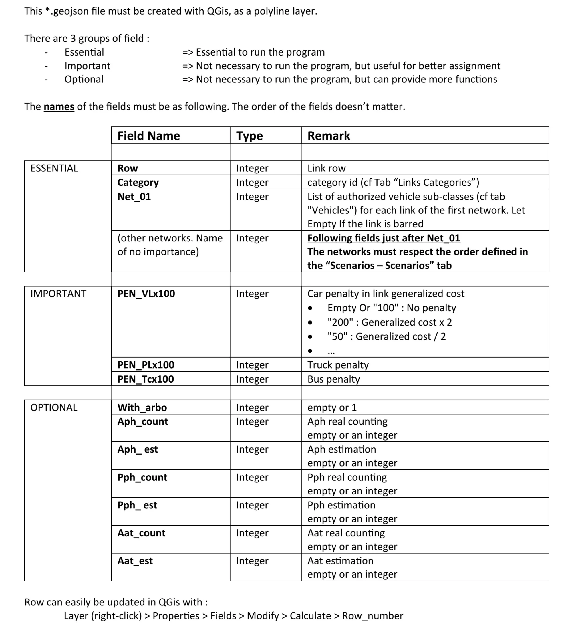
Links file (multiline QGis layer)

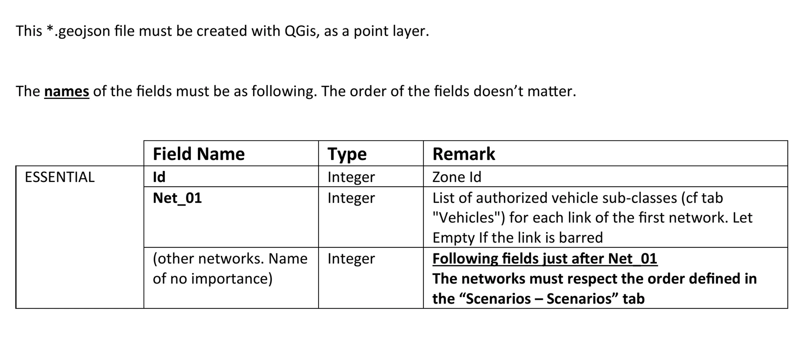
Zones file (point QGis layer)
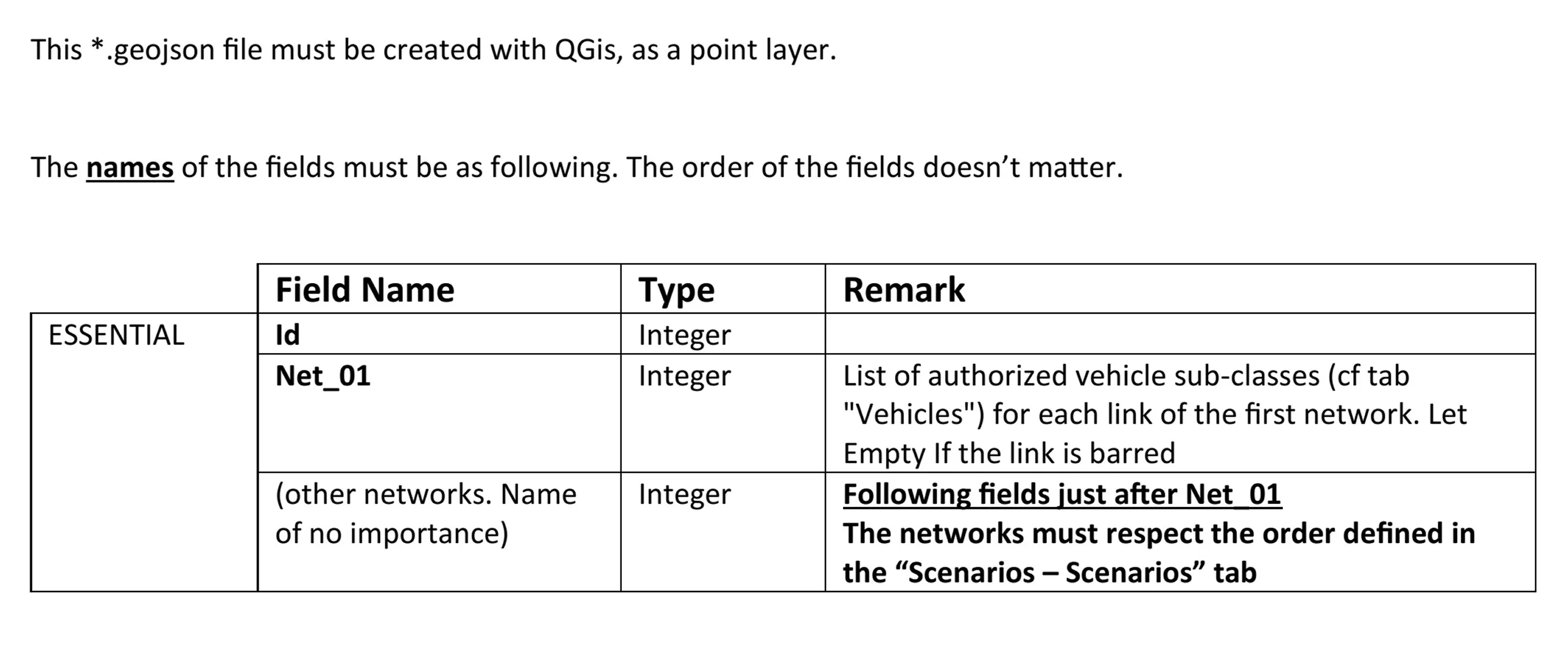
Parkings file (point QGis layer)
Matrix file
There can be a matrix file for each combination : {scenario, vehicle type, time period} (see below).
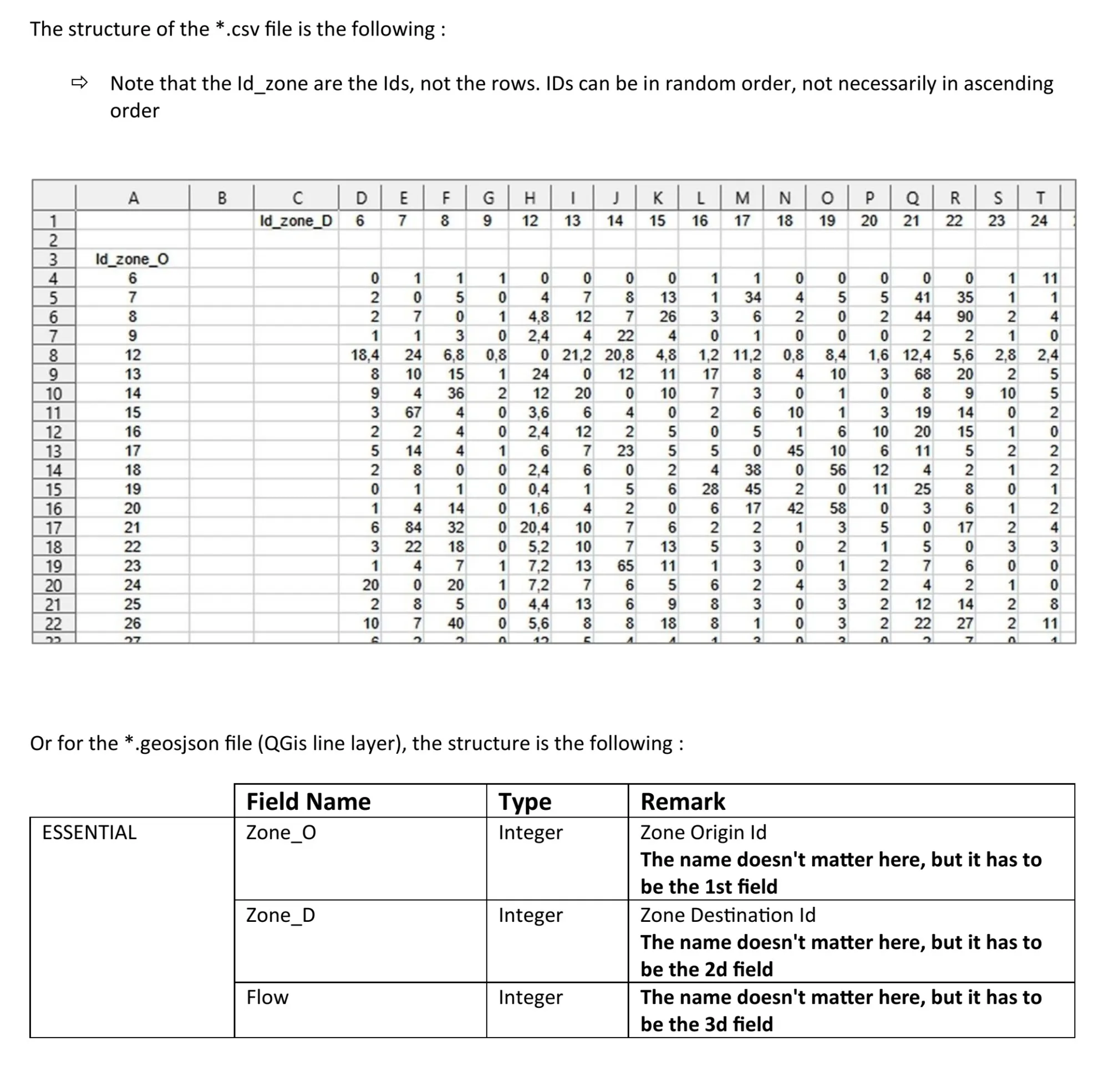
The names of the trips matrix files are not left to the user’s choice, but are automatically set by the software according to the user’s settings and choices. The names of the matrix files are composed of the names of : the project + the scenario + the vehicle type + the time period. The naming rules are as follows :
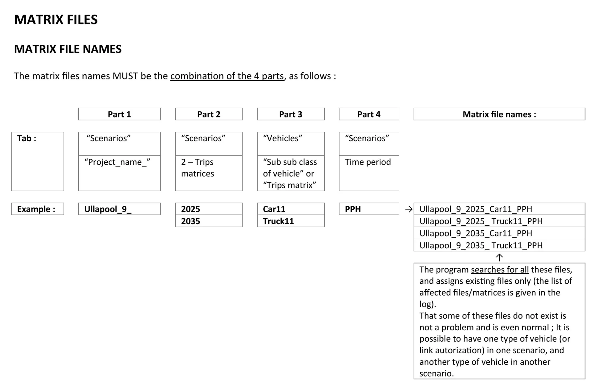
For example, a common case is to have 2 different scenarios, with 2 different road networks (with and without a bridge for example), but using the same matrices (same date, same routes), with 2 types of vehicles. There will then be 2 matrix files.
The other common case is to have 2 different scenarios, with the same road network but different trips (let’s say for 2 different time horizons), with 2 types of vehicles. There will then be 4 matrix files.
And in the case with 3 scenarios, each with a different set of matrices, and 2 types of vehicles, 6 matrices files will be used.
While the software searches for all possible combinations of matrix names, not all of them are always necessary, and the software does not create errors if it does not find all of them. This structure, which can sometimes be complicated, allows for a higher number of variations.